ملف:Crumpsall Park - geograph.org.uk - 2966.jpg
لا توجد دقة أعلى متوفرة.
Crumpsall_Park_-_geograph.org.uk_-_2966.jpg (640 × 480 بكسل حجم الملف: 112 كيلوبايت، نوع MIME: image/jpeg)
وصف قصير
| ⧼wm-license-information-description⧽ |
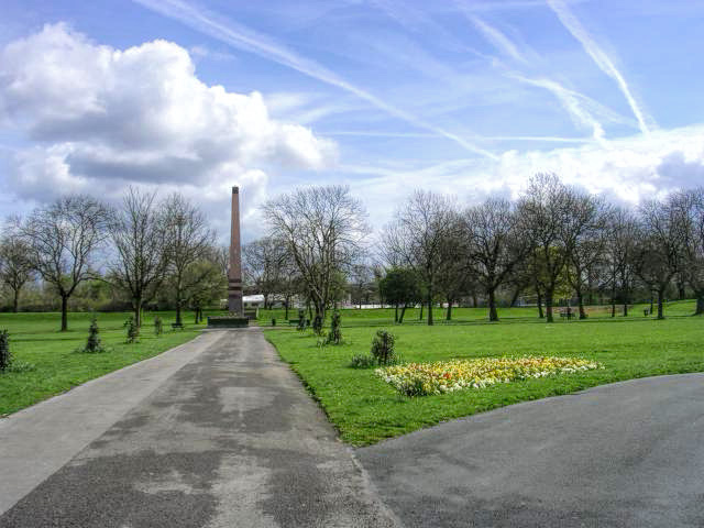
English: Crumpsall Park. This park is a green oasis in a rather run-down area of north Manchester. It was opened in the 1890's and went into serious decline in the 1980's. Recent regeneration has transformed it and it is now well used by the community it serves. The obelisk used to be situated in the centre of Manchester before being moved to here. Picture taken from SD 846 020
|
| ⧼wm-license-information-date⧽ | 2005 |
| ⧼wm-license-information-source⧽ | From geograph.org.uk |
| ⧼wm-license-information-author⧽ | Keith Williamson |
| ⧼wm-license-cc-attribution⧽ (قالب:I18n/Credit line) |
Keith Williamson / Crumpsall Park / |
53°30′56″N 2°14′04″W / 53.51557°N 2.2345°W قالب:Object location
_heading:90)
ترخيص
تاريخ الملف
اضغط على زمن/تاريخ لرؤية الملف كما بدا في هذا الزمن.
| زمن/تاريخ | صورة مصغرة | الأبعاد | مستخدم | تعليق | |
|---|---|---|---|---|---|
| حالي | ★ مراجعة معتمدة 08:52، 14 أكتوبر 2023 | | 640 × 480 (112 كيلوبايت) | Pastakhov (نقاش | مساهمات) | Upload https://upload.wikimedia.org/wikipedia/commons/d/df/Crumpsall_Park_-_geograph.org.uk_-_2966.jpg |
لا يمكنك استبدال هذا الملف.
وصلات
لا يوجد صفحات تصل لهذه الصورة.