ملف:Croatia location map, Zagreb county.svg

حجم معاينة PNG لذلك الملف ذي الامتداد SVG: 619 × 599 بكسل. البعد الآخر: 2٬116 × 2٬048 بكسل.
الملف الأصلي (ملف SVG، أبعاده 1٬097 × 1٬062 بكسل، حجم الملف: 498 كيلوبايت)
| ⧼wm-license-information-description⧽ |
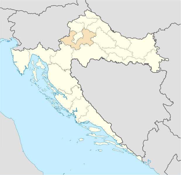
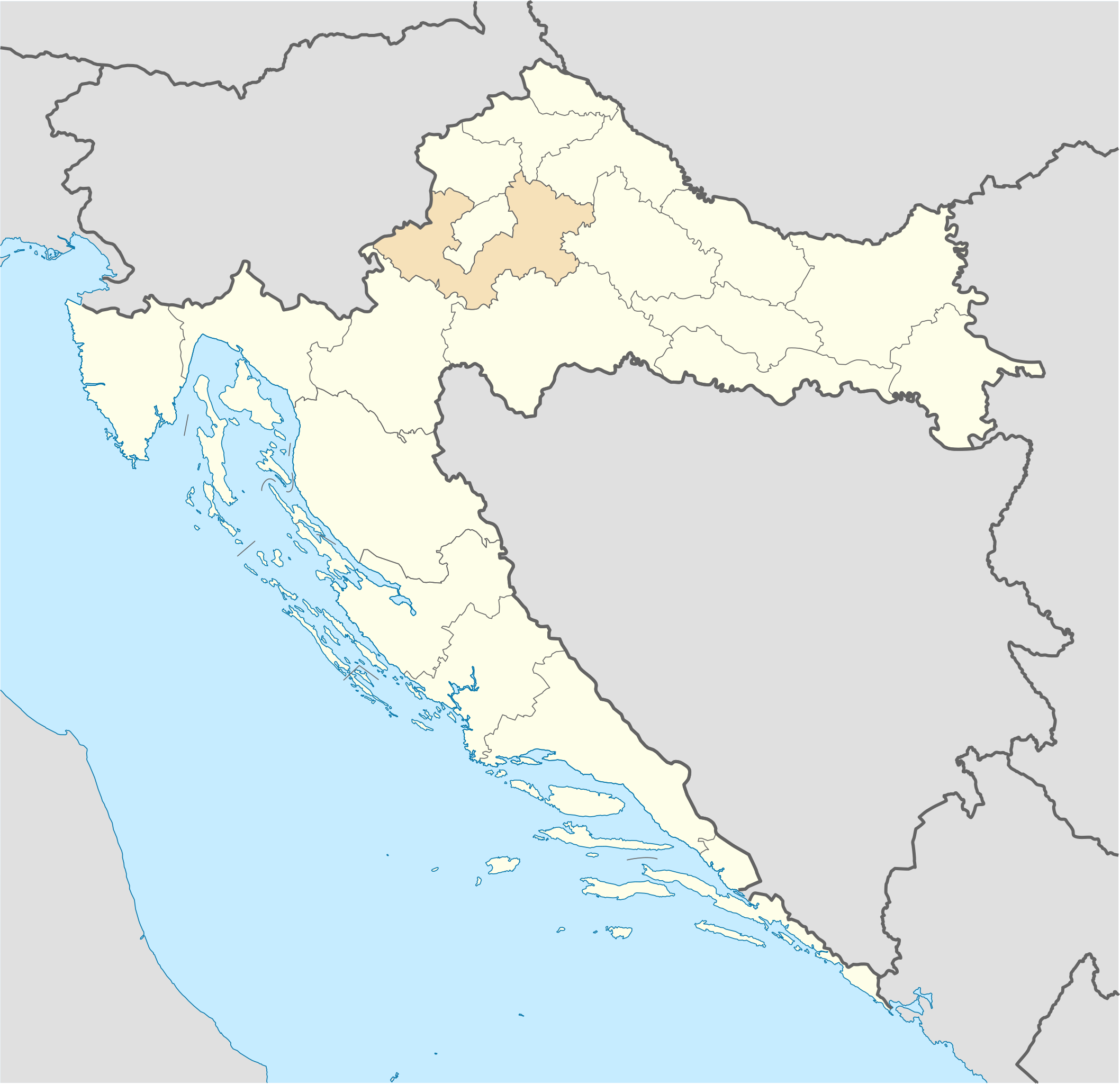
Deutsch: Positionskarte von Kroatien Hervorhebung der Gespanschaft Zagreb. Quadratische Plattkarte, N-S-Streckung 140 %. Geographische Begrenzung der Karte: * N: 46.8° N * S: 42.1° N * W: 13.1° O * O: 19.9° O English: Location map of Croatia Zagreb county highlighted. Equirectangular projection, N/S stretching 140 %. Geographic limits of the map: * N: 46.8° N * S: 42.1° N * W: 13.1° E * E: 19.9° E
|
| ⧼wm-license-information-date⧽ | 2008-09-07 22:36 (UTC) |
| ⧼wm-license-information-source⧽ | |
| ⧼wm-license-information-author⧽ |
|
| [This is a retouched picture, which means that it has been digitally altered from its original version. The original can be viewed here: Croatia_location_map.svg.] Error: {{Lang}}: text has italic markup (help)
|
|

قالب:Original upload log
This image is a derivative work of the following images:
- Image:Croatia_location_map.svg licensed with Cc-by-sa-3.0, GFDL
- 2008-08-29T08:00:53Z NordNordWest 1097x1062 (491312 Bytes)
- 2008-07-30T15:54:56Z NordNordWest 548x531 (421799 Bytes) more detailed borderlines
- 2008-07-16T16:55:30Z NordNordWest 548x531 (465194 Bytes) {{Information |Description= {{de|Positionskarte von [[:de:Kroatien|Kroatien]]}} Quadratische Plattkarte, N-S-Streckung 140 %. Geographische Begrenzung der Karte: * N: 46.8° N * S: 42.1° N * W: 13.1° O * O: 19.9° O {{en|Lo
تاريخ الملف
اضغط على زمن/تاريخ لرؤية الملف كما بدا في هذا الزمن.
| زمن/تاريخ | صورة مصغرة | الأبعاد | مستخدم | تعليق | |
|---|---|---|---|---|---|
| حالي | ★ مراجعة معتمدة 18:29، 9 نوفمبر 2023 | | 1٬097 × 1٬062 (498 كيلوبايت) | Pastakhov (نقاش | مساهمات) | Upload https://upload.wikimedia.org/wikipedia/commons/8/8f/Croatia_location_map%2C_Zagreb_county.svg |
لا يمكنك استبدال هذا الملف.
وصلات
لا يوجد صفحات تصل لهذه الصورة.