ملف:Cradle of Humankind plan.jpg
حجم هذه المعاينة: 800 × 597 بكسل. البعد الآخر: 1٬730 × 1٬291 بكسل.
الملف الأصلي (1٬730 × 1٬291 بكسل حجم الملف: 235 كيلوبايت، نوع MIME: image/jpeg)
وصف قصير
| ⧼wm-license-information-description⧽ |
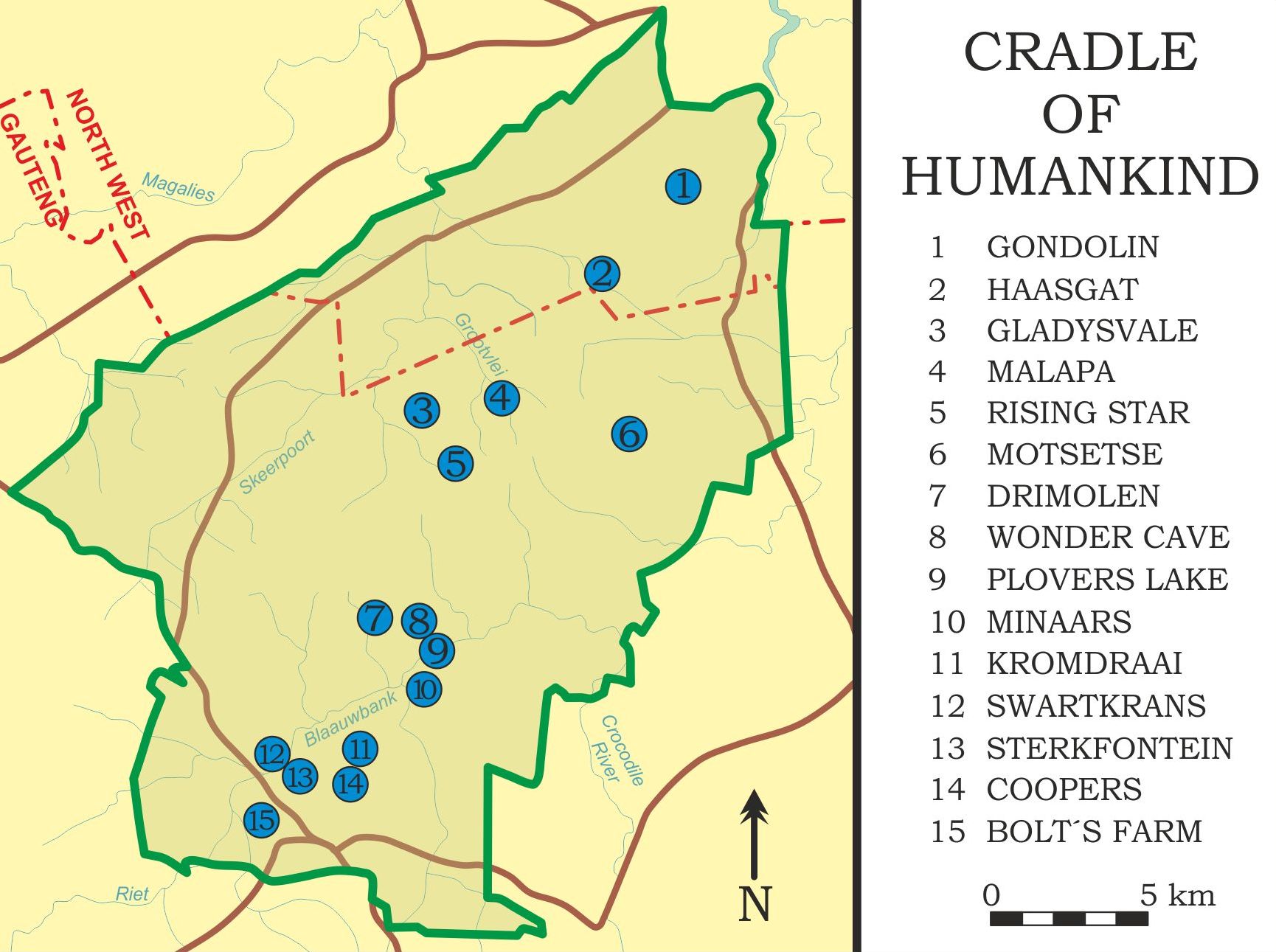
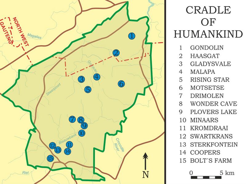
English: Cradle of Humankind map with most important caves; World heritage area, Gauteng province, South Africa
|
| ⧼wm-license-information-date⧽ | 2016, {{time}} – invalid date format 32 (help) |
| ⧼wm-license-information-source⧽ | ⧼Wm-license-own-work⧽ |
| ⧼wm-license-information-author⧽ | Chartep |
ترخيص
|
تاريخ الملف
اضغط على زمن/تاريخ لرؤية الملف كما بدا في هذا الزمن.
| زمن/تاريخ | صورة مصغرة | الأبعاد | مستخدم | تعليق | |
|---|---|---|---|---|---|
| حالي | ★ مراجعة معتمدة 16:44، 30 نوفمبر 2023 | | 1٬730 × 1٬291 (235 كيلوبايت) | Pastakhov (نقاش | مساهمات) | Upload https://upload.wikimedia.org/wikipedia/commons/2/20/Cradle_of_Humankind_plan.jpg |
لا يمكنك استبدال هذا الملف.
وصلات
لا يوجد صفحات تصل لهذه الصورة.