ملف:Clowes Wood - geograph.org.uk - 371844.jpg
لا توجد دقة أعلى متوفرة.
Clowes_Wood_-_geograph.org.uk_-_371844.jpg (640 × 480 بكسل حجم الملف: 94 كيلوبايت، نوع MIME: image/jpeg)
وصف قصير
| ⧼wm-license-information-description⧽ |
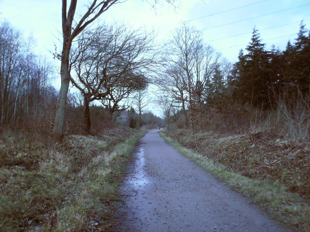
English: Clowes Wood The Canterbury and Whitstable Railway was closed in 1953. Stretches of the track bed now form part of the Crab and Winkle cycle path which connects Canterbury with the sea. Taken near the summit of the line looking down towards Whitstable.
|
| ⧼wm-license-information-date⧽ | 2007 |
| ⧼wm-license-information-source⧽ | From geograph.org.uk |
| ⧼wm-license-information-author⧽ | Thomas Grant |
| ⧼wm-license-cc-attribution⧽ (قالب:I18n/Credit line) |
Thomas Grant / Clowes Wood / |
51°19′26″N 1°03′01″E / 51.32387°N 1.0503°E قالب:Object location
_heading:0)
ترخيص
تاريخ الملف
اضغط على زمن/تاريخ لرؤية الملف كما بدا في هذا الزمن.
| زمن/تاريخ | صورة مصغرة | الأبعاد | مستخدم | تعليق | |
|---|---|---|---|---|---|
| حالي | ★ مراجعة معتمدة 17:11، 25 أكتوبر 2023 | | 640 × 480 (94 كيلوبايت) | Pastakhov (نقاش | مساهمات) | Upload https://upload.wikimedia.org/wikipedia/commons/e/e1/Clowes_Wood_-_geograph.org.uk_-_371844.jpg |
لا يمكنك استبدال هذا الملف.
وصلات
لا يوجد صفحات تصل لهذه الصورة.