ملف:Channel Islands NMS map.jpg
حجم هذه المعاينة: 774 × 600 بكسل. البعد الآخر: 2٬000 × 1٬550 بكسل.
الملف الأصلي (2٬000 × 1٬550 بكسل حجم الملف: 637 كيلوبايت، نوع MIME: image/jpeg)
وصف قصير
| ⧼wm-license-information-description⧽ |
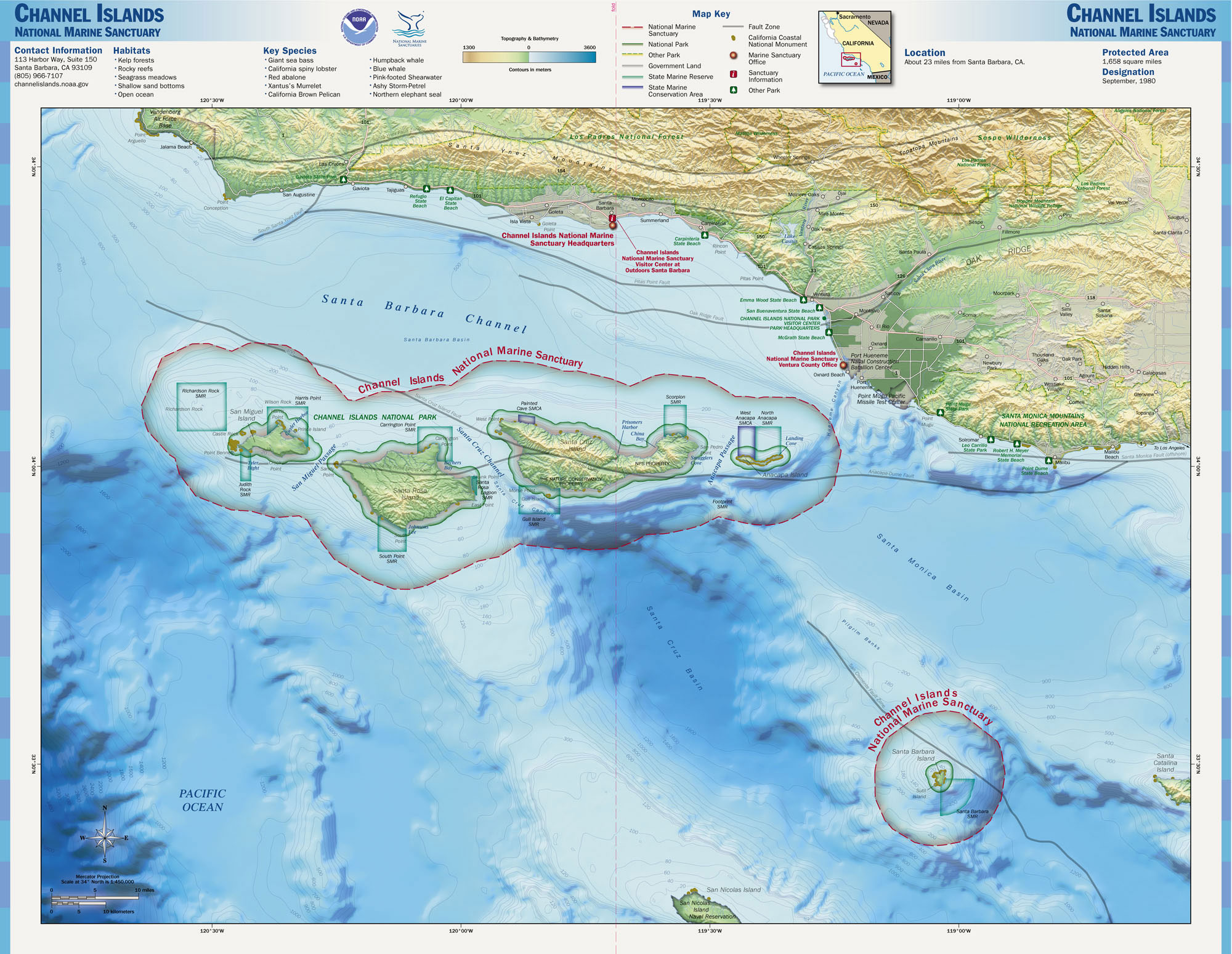
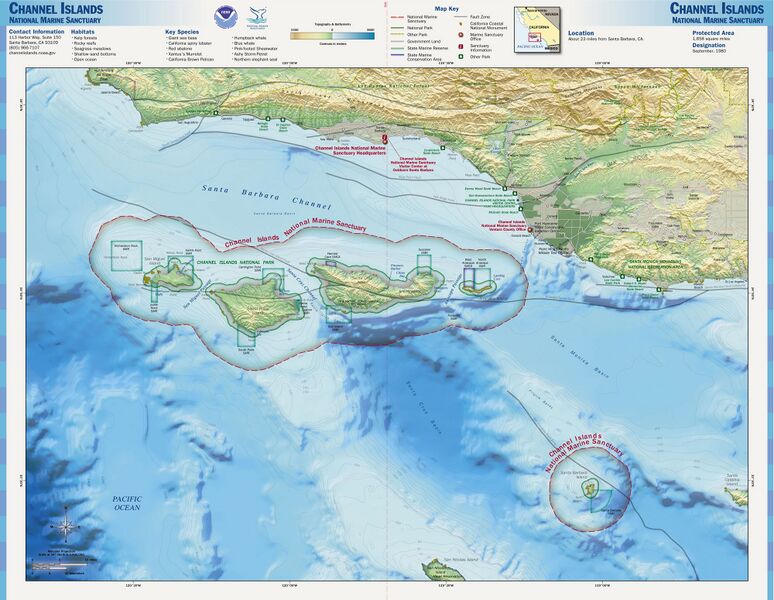
English: Map of the Channel Islands National Marine Sanctuary — Southern California.
|
||
| ⧼wm-license-information-date⧽ | |||
| ⧼wm-license-information-source⧽ | http://www.sanctuaries.noaa.gov/pgallery/atlasmaps/ci.html | ||
| ⧼wm-license-information-author⧽ | NOAA, National Marine Sanctuaries | ||
| ⧼wm-license-information-permission⧽ (⧼wm-license-information-permission-reusing-text⧽) |
|

تاريخ الملف
اضغط على زمن/تاريخ لرؤية الملف كما بدا في هذا الزمن.
| زمن/تاريخ | صورة مصغرة | الأبعاد | مستخدم | تعليق | |
|---|---|---|---|---|---|
| حالي | ★ مراجعة معتمدة 22:11، 14 ديسمبر 2023 | | 2٬000 × 1٬550 (637 كيلوبايت) | Pastakhov (نقاش | مساهمات) | Upload https://upload.wikimedia.org/wikipedia/commons/0/04/Channel_Islands_NMS_map.jpg |
لا يمكنك استبدال هذا الملف.
وصلات
لا يوجد صفحات تصل لهذه الصورة.