ملف:Brisbane Aerial From Satellite.jpg

حجم هذه المعاينة: 593 × 600 بكسل. البعد الآخر: 790 × 799 بكسل.
الملف الأصلي (790 × 799 بكسل حجم الملف: 169 كيلوبايت، نوع MIME: image/jpeg)
وصف قصير
| ⧼wm-license-information-description⧽ |
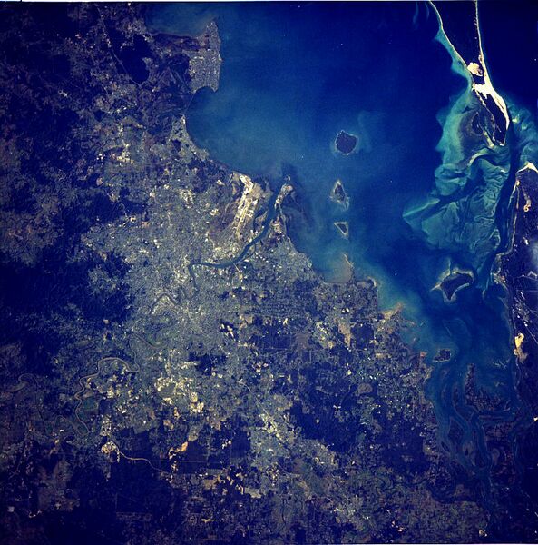
English: satellite image of the Brisbane Metropolitan Area and surrounding Islands of Moreton Bay
|
| ⧼wm-license-information-date⧽ | 1984 |
| ⧼wm-license-information-source⧽ | http://eol.jsc.nasa.gov/sseop/EFS/photoinfo.pl?PHOTO=STS41D-41-62 [1] |
| ⧼wm-license-information-author⧽ | NASA |
![[1]](http://eol.jsc.nasa.gov/sseop/images/city/lowres/STS41D/STS41D-41-62.JPG)
ترخيص
قالب:Original upload log
قالب:Original description page
- 2008-06-18 11:27 Lav90 790×799×8 (173171 bytes) {{Information |Description=satellite image of the Brisbane Metropolitan Area and surrounding Islands of Moreton Bay |Source=http://eol.jsc.nasa.gov/cities/search.pl?lon=-115.154297&lat=36.161572 |Date= |Author= NASA |Permission= |other_versions= }}
تاريخ الملف
اضغط على زمن/تاريخ لرؤية الملف كما بدا في هذا الزمن.
| زمن/تاريخ | صورة مصغرة | الأبعاد | مستخدم | تعليق | |
|---|---|---|---|---|---|
| حالي | ★ مراجعة معتمدة 23:17، 15 يناير 2024 | | 790 × 799 (169 كيلوبايت) | Pastakhov (نقاش | مساهمات) | Upload https://upload.wikimedia.org/wikipedia/commons/8/85/Brisbane_Aerial_From_Satellite.jpg |
لا يمكنك استبدال هذا الملف.
وصلات
لا يوجد صفحات تصل لهذه الصورة.