ملف:Bjäre Västra Karup.svg

حجم معاينة PNG لذلك الملف ذي الامتداد SVG: 800 × 522 بكسل. البعد الآخر: 2٬560 × 1٬671 بكسل.
الملف الأصلي (ملف SVG، أبعاده 1٬091 × 712 بكسل، حجم الملف: 1٫22 ميجابايت)
| ⧼wm-license-information-description⧽ |
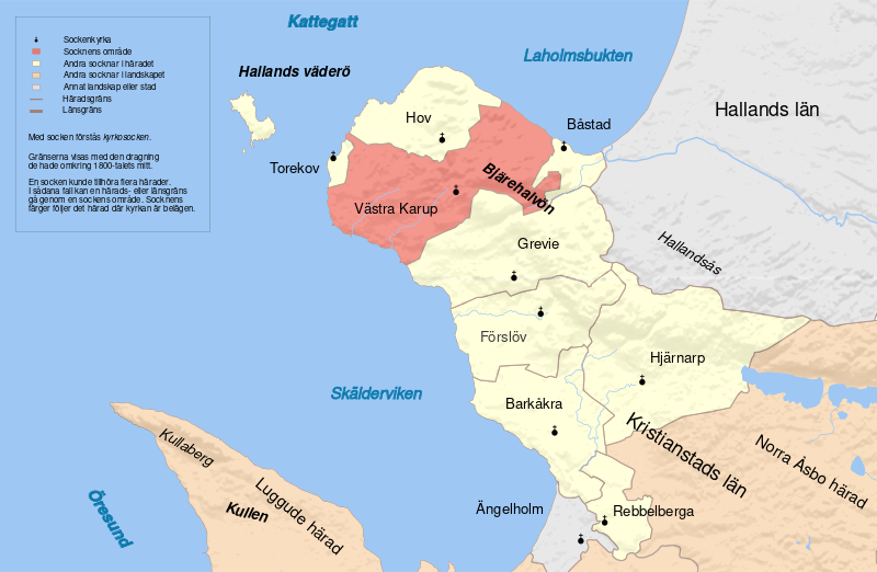
English: Map showing the parish Västra Karup in the hundred of Bjäre, Skåne, Sweden. Based on Generalstabskartan, relief from a digital elevation model of the Shuttle Radar Topography Mission
|
||
| ⧼wm-license-information-date⧽ | |||
| ⧼wm-license-information-source⧽ | ⧼Wm-license-own-work⧽ | ||
| ⧼wm-license-information-author⧽ | Edaen | ||
| ⧼wm-license-information-permission⧽ (⧼wm-license-information-permission-reusing-text⧽) |
|
تاريخ الملف
اضغط على زمن/تاريخ لرؤية الملف كما بدا في هذا الزمن.
| زمن/تاريخ | صورة مصغرة | الأبعاد | مستخدم | تعليق | |
|---|---|---|---|---|---|
| حالي | ★ مراجعة معتمدة 22:55، 27 أكتوبر 2023 | | 1٬091 × 712 (1٫22 ميجابايت) | Pastakhov (نقاش | مساهمات) | Upload https://upload.wikimedia.org/wikipedia/commons/b/bc/Bj%C3%A4re_V%C3%A4stra_Karup.svg |
لا يمكنك استبدال هذا الملف.
وصلات
لا يوجد صفحات تصل لهذه الصورة.