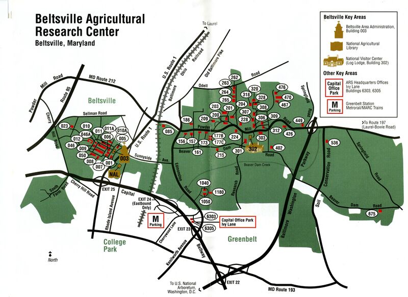
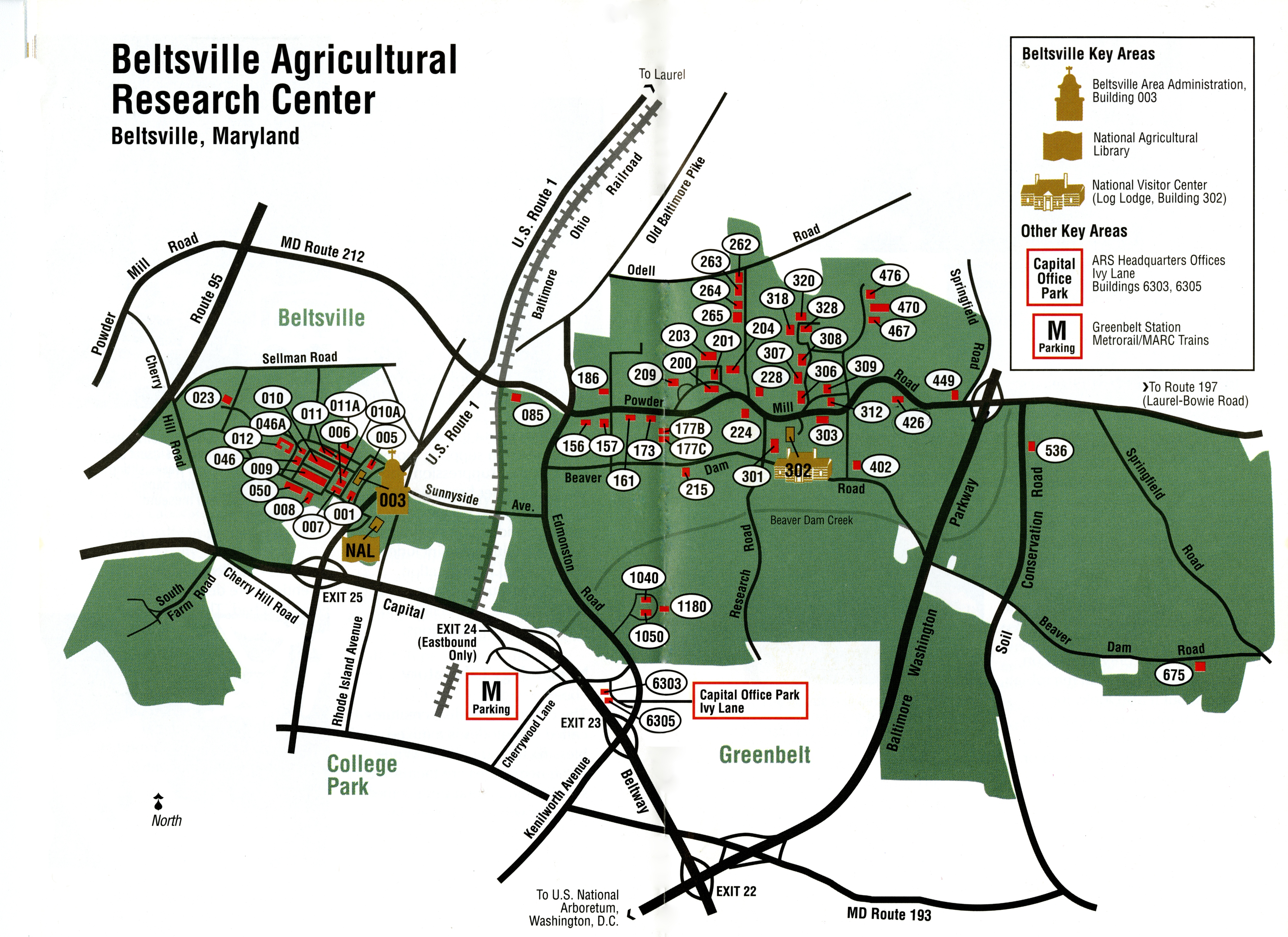
ملف:Beltsville Agricultural Research Center, Maryland, map.jpg

حجم هذه المعاينة: 800 × 582 بكسل. البعدان الآخران: 2٬560 × 1٬862 بكسل | 4٬000 × 2٬910 بكسل.
الملف الأصلي (4٬000 × 2٬910 بكسل حجم الملف: 4٫82 ميجابايت، نوع MIME: image/jpeg)
وصف قصير
| ⧼wm-license-information-description⧽ |
English: Title: Beltsville Agricultural Research Center, Maryland, map
Subject: USDA Beltsville Agricultural Research Center Metadata: output=omeka-xml |
| ⧼wm-license-information-date⧽ | تاريخ غير معروف |
| ⧼wm-license-information-source⧽ | Special Collections, National Agricultural Library (NAL), United States Department of Agriculture (USDA): www.nal.usda.gov/exhibits/speccoll/items/show/8896 : www.nal.usda.gov/exhibits/speccoll/files/original/622a787f1e77ca608d58676acb6d6e76.jpg |
| ⧼wm-license-information-author⧽ | USDA, Agricultural Research Service |
ترخيص
تاريخ الملف
اضغط على زمن/تاريخ لرؤية الملف كما بدا في هذا الزمن.
| زمن/تاريخ | صورة مصغرة | الأبعاد | مستخدم | تعليق | |
|---|---|---|---|---|---|
| حالي | ★ مراجعة معتمدة 13:03، 4 نوفمبر 2023 | | 4٬000 × 2٬910 (4٫82 ميجابايت) | Pastakhov (نقاش | مساهمات) | Upload https://upload.wikimedia.org/wikipedia/commons/2/24/Beltsville_Agricultural_Research_Center%2C_Maryland%2C_map.jpg |
لا يمكنك استبدال هذا الملف.
وصلات
لا يوجد صفحات تصل لهذه الصورة.