ملف:Aiguille du Bionnassay.jpg
حجم هذه المعاينة: 800 × 600 بكسل. البعدان الآخران: 2٬560 × 1٬920 بكسل | 2٬816 × 2٬112 بكسل.
الملف الأصلي (2٬816 × 2٬112 بكسل حجم الملف: 1٫61 ميجابايت، نوع MIME: image/jpeg)
وصف قصير
| ⧼wm-license-information-description⧽ |
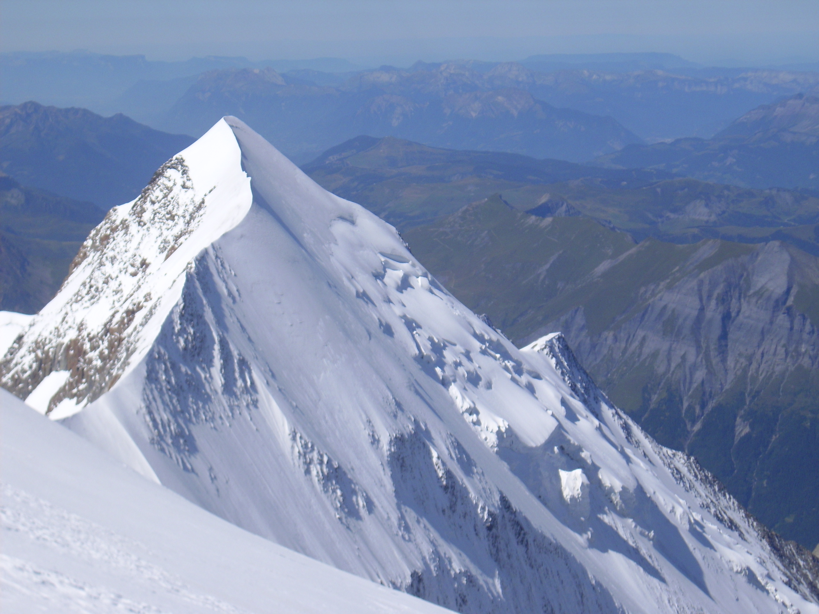
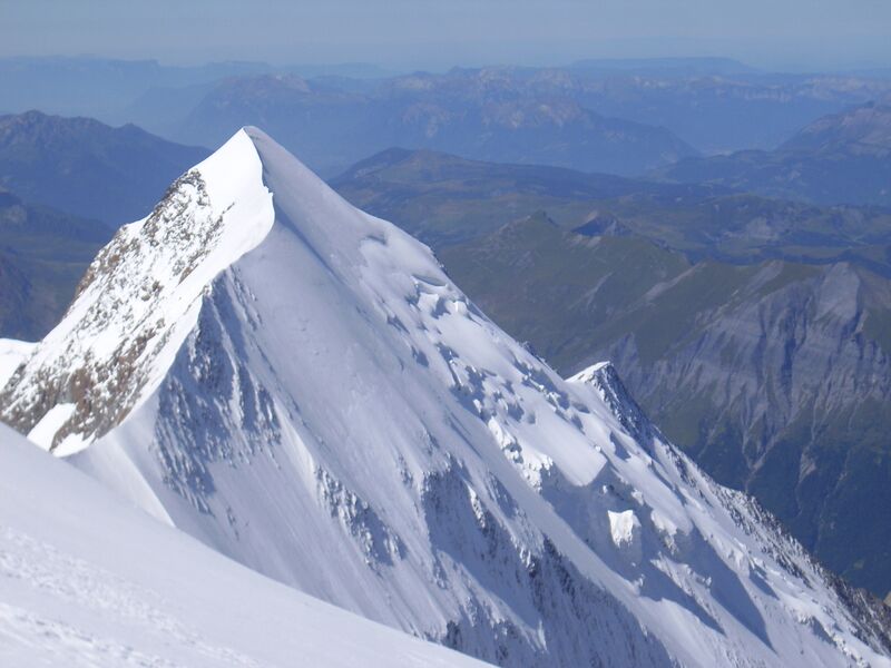
Aiguille de Bionnassay viewed from the environs of the Dome du Gouter. The knife-edge East ridge is clearly visible and forms the frontier between Italy (left) and France (right). The steep and glaciated North and North-west faces lie to the right, with the Aiguille de Tricot visible beyond. |
| ⧼wm-license-information-date⧽ | 2011 |
| ⧼wm-license-information-source⧽ | ⧼Wm-license-own-work⧽ |
| ⧼wm-license-information-author⧽ | WikiSephiroth |
ترخيص
|
تاريخ الملف
اضغط على زمن/تاريخ لرؤية الملف كما بدا في هذا الزمن.
| زمن/تاريخ | صورة مصغرة | الأبعاد | مستخدم | تعليق | |
|---|---|---|---|---|---|
| حالي | ★ مراجعة معتمدة 08:37، 18 أكتوبر 2023 | | 2٬816 × 2٬112 (1٫61 ميجابايت) | Pastakhov (نقاش | مساهمات) | Upload https://upload.wikimedia.org/wikipedia/commons/2/2b/Aiguille_du_Bionnassay.jpg |
لا يمكنك استبدال هذا الملف.
وصلات
لا يوجد صفحات تصل لهذه الصورة.