ملف:Achaemenid Empire 500 BC.png
حجم هذه المعاينة: 800 × 427 بكسل. البعد الآخر: 3٬070 × 1٬637 بكسل.
الملف الأصلي (3٬070 × 1٬637 بكسل حجم الملف: 811 كيلوبايت، نوع MIME: image/png)
وصف قصير
| ⧼wm-license-information-description⧽ |
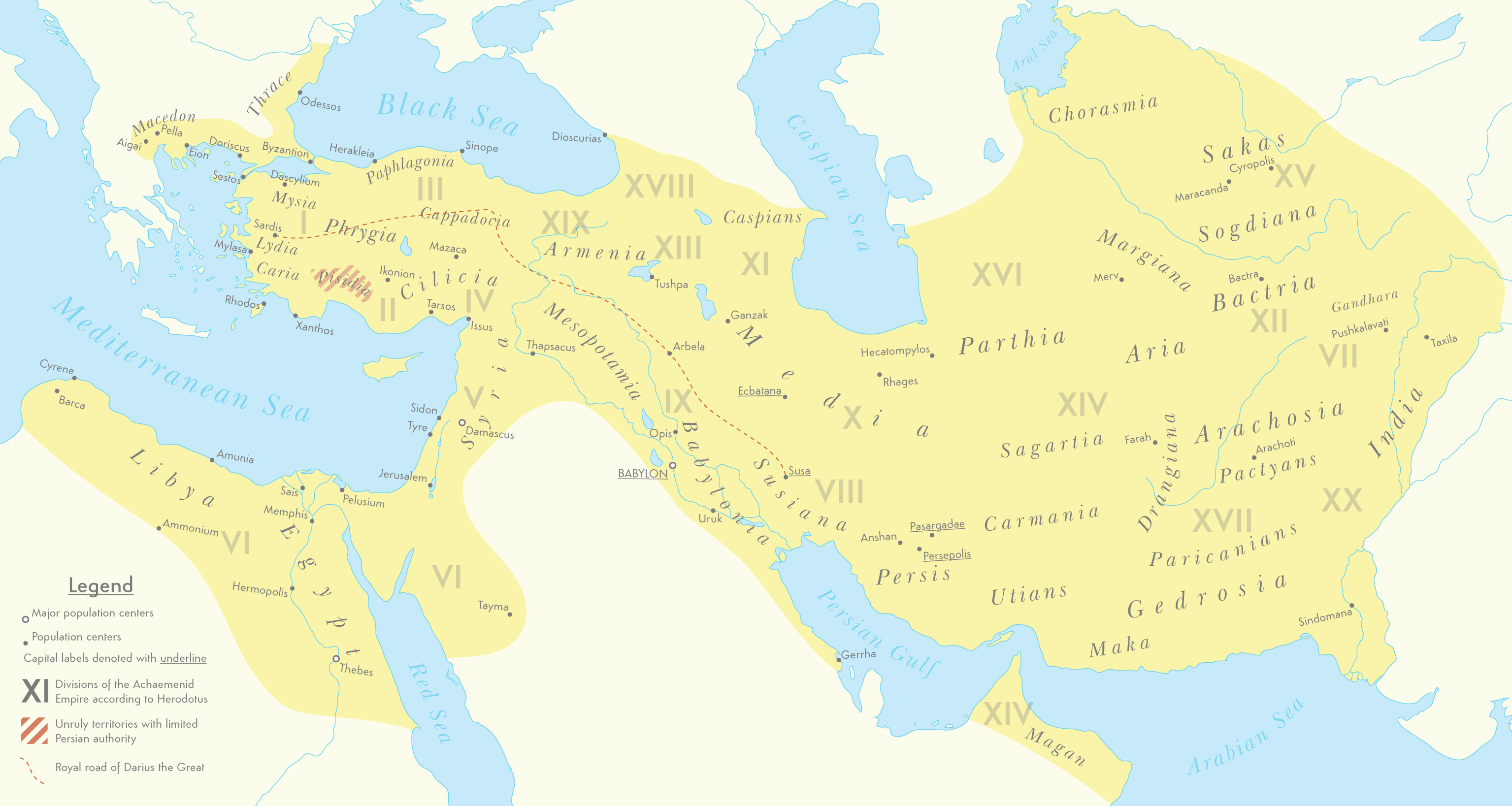
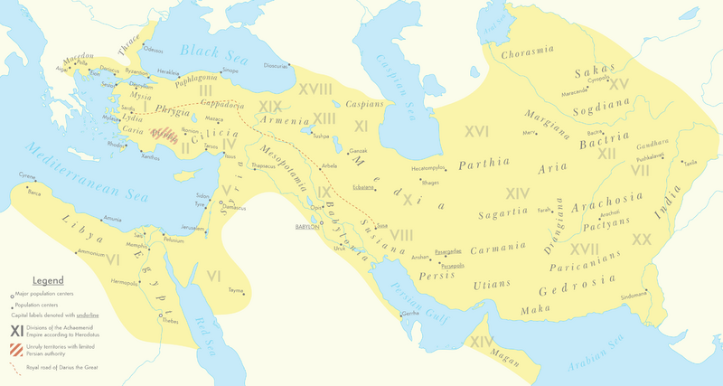
English: A map of the Achaemenid Empire around 500 BC featuring ancient regions, settlements and Satrapies.
This map assembles information from the Historischer Schul-Atlas zur alten, mittleren und neueren Geschichte by Heinrich Kiepert and Carl Wolff from 1879 as accessed from GEI Digital, the 1923 edition of Historical Atlas by William R. Shepherd as accessed from the Perry-Castañeda Library's online map collection and Livius.org's article on the Satrapies of the Achaemenid Empire according to Herodotus. |
| ⧼wm-license-information-date⧽ | 2021 |
| ⧼wm-license-information-source⧽ | ⧼Wm-license-own-work⧽ |
| ⧼wm-license-information-author⧽ | Cattette |
ترخيص
تاريخ الملف
اضغط على زمن/تاريخ لرؤية الملف كما بدا في هذا الزمن.
| زمن/تاريخ | صورة مصغرة | الأبعاد | مستخدم | تعليق | |
|---|---|---|---|---|---|
| حالي | ★ مراجعة معتمدة 11:18، 12 أكتوبر 2023 | | 3٬070 × 1٬637 (811 كيلوبايت) | Pastakhov (نقاش | مساهمات) | Upload https://upload.wikimedia.org/wikipedia/commons/2/2f/Achaemenid_Empire_500_BC.png |
لا يمكنك استبدال هذا الملف.
وصلات
لا يوجد صفحات تصل لهذه الصورة.