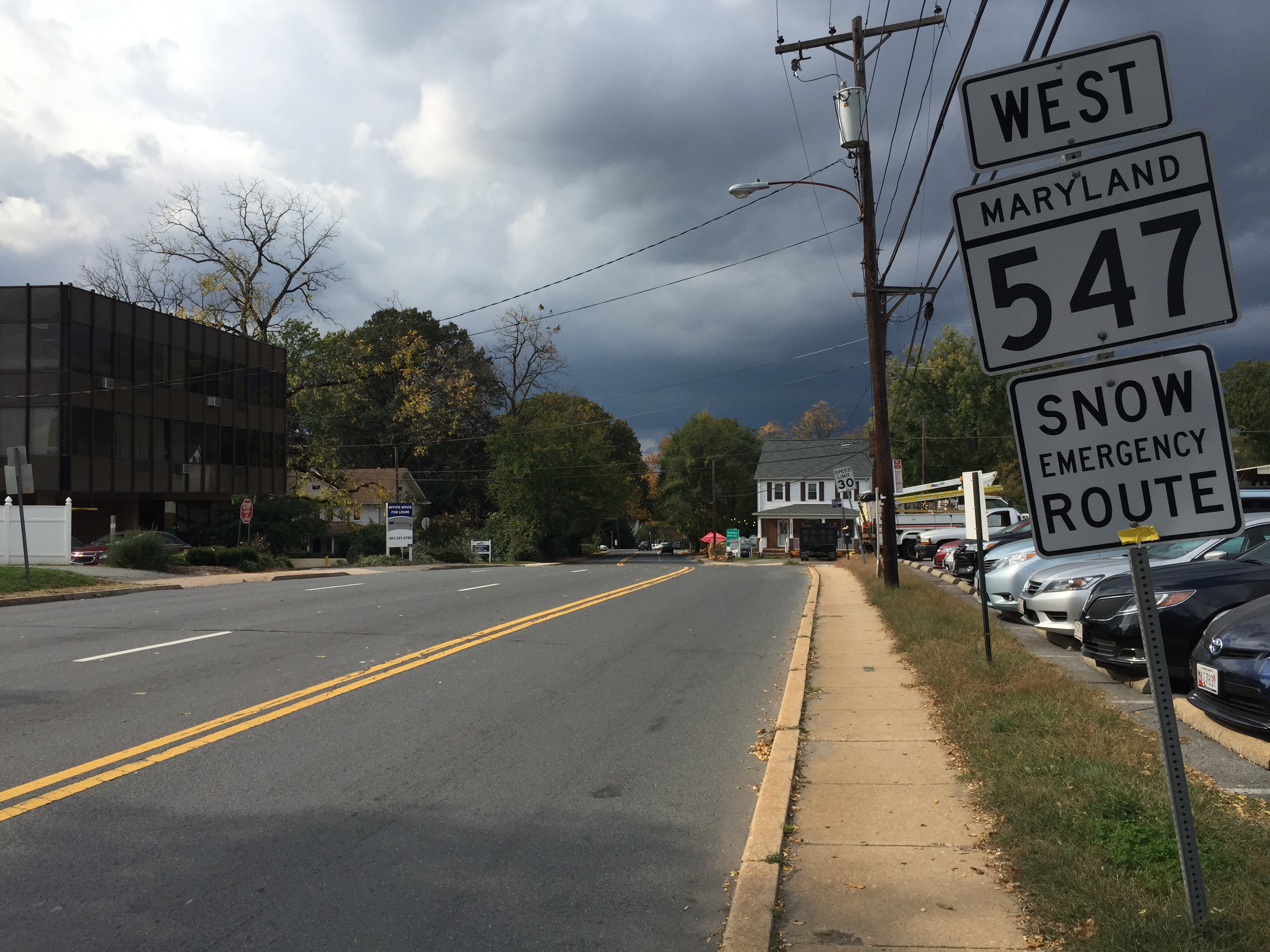
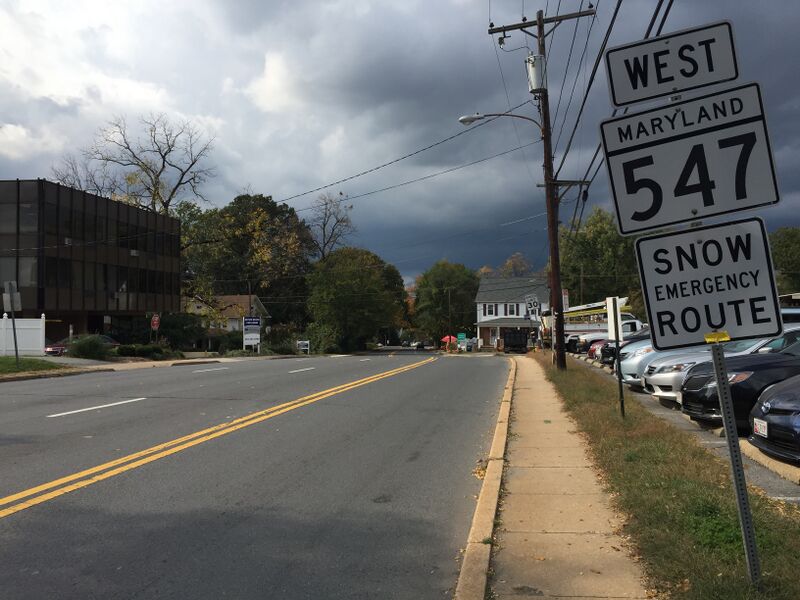
ملف:2016-10-21 13 31 48 View west along Maryland State Route 547 (Knowles Avenue) at Maryland State Route 185 (Connecticut Avenue) in Kensington, Montgomery County, Maryland.jpg
حجم هذه المعاينة: 800 × 600 بكسل. البعدان الآخران: 2٬560 × 1٬920 بكسل | 3٬264 × 2٬448 بكسل.
الملف الأصلي (3٬264 × 2٬448 بكسل حجم الملف: 2٫41 ميجابايت، نوع MIME: image/jpeg)
وصف قصير
| ⧼wm-license-information-description⧽ |
English: View west along Maryland State Route 547 (Knowles Avenue) at Maryland State Route 185 (Connecticut Avenue) in Kensington, Montgomery County, Maryland
|
| ⧼wm-license-information-date⧽ | 2016, {{time}} – invalid date format 31 (help) |
| ⧼wm-license-information-source⧽ | ⧼Wm-license-own-work⧽ |
| ⧼wm-license-information-author⧽ | Famartin |
39°01′40″N 77°04′38″W / 39.027675°N 77.077269°W
_at_Maryland_State_Route_185_(Connecticut_Avenue)_in_Kensington,_Montgomery_County,_Maryland.jpg¶ms=39.027675_N_77.077269_W_heading:98.70315789473685)
ترخيص
|
تاريخ الملف
اضغط على زمن/تاريخ لرؤية الملف كما بدا في هذا الزمن.
| زمن/تاريخ | صورة مصغرة | الأبعاد | مستخدم | تعليق | |
|---|---|---|---|---|---|
| حالي | ★ مراجعة معتمدة 02:34، 7 نوفمبر 2023 | | 3٬264 × 2٬448 (2٫41 ميجابايت) | Pastakhov (نقاش | مساهمات) | Upload https://upload.wikimedia.org/wikipedia/commons/b/b1/2016-10-21_13_31_48_View_west_along_Maryland_State_Route_547_%28Knowles_Avenue%29_at_Maryland_State_Route_185_%28Connecticut_Avenue%29_in_Kensington%2C_Montgomery_County%2C_Maryland.jpg |
لا يمكنك استبدال هذا الملف.
وصلات
لا يوجد صفحات تصل لهذه الصورة.
_at_Maryland_State_Route_185_(Connecticut_Avenue)_in_Kensington,_Montgomery_County,_Maryland.jpg&oldid=3399505)