تايشت
تايشت (روسية: Тайшет; النطق الروسي: [tɐjˈʂɛt]، حرفياً النهر البارد بلغة كت؛ إنگليزية: Tayshet) هي بلدة و المركز الاداري of Tayshetsky District في أوبلاست إركوتسك، روسيا, وتقع على بعد 669 كم شمال غرب إركوتسك، المركز الاداري للأوبلاست. Population: 35,485 (تعداد 2010);[5] 38,535 (تعداد 2002);[10] 42,391 (تعداد 1989).[11]
Tayshet
Тайшет | |
|---|---|
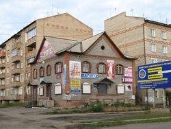
 In Tayshet | |
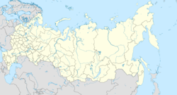
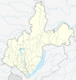
| الإحداثيات: 55°57′N 98°01′E / 55.950°N 98.017°ECoordinates: 55°57′N 98°01′E / 55.950°N 98.017°E | |
| البلد | روسيا |
| الكيان الاتحادي | Irkutsk Oblast[1] |
| Administrative district | Tayshetsky District[2] |
| Founded | 1897[3] |
| Town status since | 1938[3] |
| الحكومة | |
| • Head[4] | Alexander Zaika[4] |
| المنسوب | 320 m (1٬050 ft) |
| التعداد | |
| • الإجمالي | 35٬485 |
| • Estimate (2018) | 33٬043 (−6٫9%) |
| • Capital of | Tayshetsky District[6] |
| • Municipal district | Tayshetsky Municipal District[7] |
| • Urban settlement | Tayshetskoye Urban Settlement[7] |
| • Capital of | Tayshetsky Municipal District[7], Tayshetskoye Urban Settlement[7] |
| منطقة التوقيت | UTC+ ([8]) |
| Postal code(s)[9] | 664802, 665000–665006, 665008–665010 |
| Dialing code(s) | +7 39563 |
| OKTMO ID | 25636101001 |
| الموقع الإلكتروني | gorodtaishet |
. . . . . . . . . . . . . . . . . . . . . . . . . . . . . . . . . . . . . . . . . . . . . . . . . . . . . . . . . . . . . . . . . . . . . . . . . . . . . . . . . . . . . . . . . . . . . . . . . . . . . . . . . . . . . . . . . . . . . . . . . . . . . . . . . . . . . . . . . . . . . . . . . . . . . . . . . . . . . . . . . . . . . . . .
التاريخ
It was founded in 1897 as a supply point and station on the Trans-Siberian Railway and was granted town status in 1938.[3]
During the 1930s–1950s, Tayshet was the center of administration for gulag labor camps Ozerlag and Angarstroy. Construction of the first section of the Baikal–Amur Mainline started in 1937 and was managed from here. According to some survivor accounts, between Tayshet and Bratsk there is "a dead man under every sleeper." Along with Japanese prisoners from the Kwantung Army, German prisoners of war formed a large proportion of the forced labor contingent, generally under a 25-year sentence, such as Dietrich von Saucken. Surviving German POWs were repatriated in autumn of 1955, after West German Chancellor Konrad Adenauer's visit to Moscow.
الوضع الاداري والبلدي
Within the framework of administrative divisions, Tayshet serves as the administrative center of Tayshetsky District,[6] to which it is directly subordinated.[2] As a municipal division, the town of Tayshet is incorporated within Tayshetsky Municipal District as Tayshetskoye Urban Settlement.[7]
المناخ
Tayshet has a subarctic climate (Köppen Dfc) bordering on a humid continental climate with warm, humid summers and severely cold, drier winters. The monthly 24-hour average temperature ranges from −18.9 °C (−2.0 °F) in January to 18.4 °C (65.1 °F). Sunshine is generous and the area receives 2,150 hours of bright sunshine annually.
| بيانات المناخ في تايشت (1953−2011) | |||||||||||||
|---|---|---|---|---|---|---|---|---|---|---|---|---|---|
| الشهر | Jan | Feb | Mar | Apr | May | Jun | Jul | Aug | Sep | Oct | Nov | Dec | Year |
| Record high °C (°F) | 6.9 (44.4) |
9.9 (49.8) |
17.0 (62.6) |
27.8 (82.0) |
33.6 (92.5) |
36.2 (97.2) |
36.3 (97.3) |
35.7 (96.3) |
32.3 (90.1) |
24.6 (76.3) |
13.9 (57.0) |
9.0 (48.2) |
36.3 (97.3) |
| القصوى المتوسطة °C (°F) | −13.9 (7.0) |
−10.0 (14.0) |
−1.6 (29.1) |
6.9 (44.4) |
15.7 (60.3) |
22.7 (72.9) |
24.7 (76.5) |
21.5 (70.7) |
14.5 (58.1) |
5.6 (42.1) |
−5.3 (22.5) |
−12.7 (9.1) |
5.8 (42.4) |
| Daily mean °C (°F) | −18.9 (−2.0) |
−16.2 (2.8) |
−8.1 (17.4) |
1.2 (34.2) |
9.0 (48.2) |
15.9 (60.6) |
18.4 (65.1) |
15.2 (59.4) |
8.3 (46.9) |
0.6 (33.1) |
−9.8 (14.4) |
−17.3 (0.9) |
0.0 (32.0) |
| الدنيا المتوسطة °C (°F) | −24.0 (−11.2) |
−22.0 (−7.6) |
−14.3 (6.3) |
−3.8 (25.2) |
2.5 (36.5) |
9.0 (48.2) |
11.8 (53.2) |
9.2 (48.6) |
3.2 (37.8) |
−3.5 (25.7) |
−14.1 (6.6) |
−22.1 (−7.8) |
−5.5 (22.1) |
| Record low °C (°F) | −50.0 (−58.0) |
−47.8 (−54.0) |
−41.8 (−43.2) |
−28.5 (−19.3) |
−10.3 (13.5) |
−5.3 (22.5) |
−0.5 (31.1) |
−3.9 (25.0) |
−10.2 (13.6) |
−32.6 (−26.7) |
−47.2 (−53.0) |
−48.9 (−56.0) |
−50.0 (−58.0) |
| Average precipitation mm (inches) | 28.7 (1.13) |
21.8 (0.86) |
21.6 (0.85) |
37.3 (1.47) |
60.4 (2.38) |
45.5 (1.79) |
55.7 (2.19) |
70.5 (2.78) |
43.3 (1.70) |
45.7 (1.80) |
30.0 (1.18) |
23.6 (0.93) |
484.1 (19.06) |
| Average precipitation days (≥ 0.1 mm) | 20.6 | 18.1 | 16.2 | 13.9 | 13.0 | 11.5 | 10.9 | 12.2 | 13.9 | 18.4 | 20.7 | 21.4 | 190.8 |
| Average relative humidity (%) | 79.9 | 75.6 | 66.8 | 61.0 | 56.9 | 67.0 | 74.0 | 76.7 | 73.7 | 74.6 | 78.2 | 80.9 | 72.1 |
| Mean monthly sunshine hours | 71.3 | 120.4 | 189.1 | 228.0 | 279.0 | 294.0 | 300.7 | 260.4 | 171.0 | 105.4 | 75.0 | 58.9 | 2٬153٫2 |
| Source: climatebase.ru | |||||||||||||
المواصلات
Tayshet railway station is a major railway junction. Here the Baikal–Amur Mainline begins, branching northeast from the Trans-Siberian Railway. Here also the Abakan-Taishet Railway ends. The town is also on the M53 Highway (Moscow to Irkutsk).
المراجع
الهامش
- ^ أ ب Charter of Irkutsk Oblast
- ^ أ ب Registry of the Administrative-Territorial Formations of Irkutsk Oblast
- ^ أ ب ت "General Information" (in russian). Irkutsk Oblast. Retrieved September 3, 2017.
{{cite web}}: CS1 maint: unrecognized language (link) - ^ أ ب Official website of Tayshet (بالروسية)
- ^ أ ب Russian Federal State Statistics Service (2011). "Всероссийская перепись населения 2010 года. Том 1". Всероссийская перепись населения 2010 года (2010 All-Russia Population Census) (in Russian). Federal State Statistics Service. Retrieved June 29, 2012.
{{cite web}}: Invalid|ref=harv(help); Unknown parameter|trans_title=ignored (|trans-title=suggested) (help)CS1 maint: unrecognized language (link) - ^ أ ب Law #49-OZ
- ^ أ ب ت ث ج Law #100-oz
- ^ "Об исчислении времени". Официальный интернет-портал правовой информации (in Russian). 3 June 2011. Retrieved 19 January 2019.
{{cite web}}: CS1 maint: unrecognized language (link) - ^ Почта России. Информационно-вычислительный центр ОАСУ РПО. (Russian Post). Поиск объектов почтовой связи (Postal Objects Search) (in روسية)
- ^ Федеральная служба государственной статистики (Federal State Statistics Service) (2004-05-21). "Численность населения России, субъектов Российской Федерации в составе федеральных округов, районов, городских поселений, сельских населённых пунктов – районных центров и сельских населённых пунктов с населением 3 тысячи и более человек[[Category:Articles containing روسية-language text]][[Category:Lang and lang-xx using deprecated ISO 639 codes|ru]] (Population of Russia, its federal districts, federal subjects, districts, urban localities, rural localities—administrative centers, and rural localities with population of over 3,000)". Всероссийская перепись населения 2002 года (All-Russia Population Census of 2002) (in Russian). Federal State Statistics Service. Retrieved 2008-07-25.
{{cite web}}: URL–wikilink conflict (help)CS1 maint: multiple names: authors list (link) CS1 maint: numeric names: authors list (link) CS1 maint: unrecognized language (link) - ^ "Всесоюзная перепись населения 1989 г. Численность наличного населения союзных и автономных республик, автономных областей и округов, краёв, областей, районов, городских поселений и сёл-райцентров.[[Category:Articles containing روسية-language text]][[Category:Lang and lang-xx using deprecated ISO 639 codes|ru]] (All Union Population Census of 1989. Present population of union and autonomous republics, autonomous oblasts and okrugs, krais, oblasts, districts, urban settlements, and villages serving as district administrative centers.)". Всесоюзная перепись населения 1989 года (All-Union Population Census of 1989) (in Russian). Demoscope Weekly (website of the Institute of Demographics of the State University—Higher School of Economics. 1989. Retrieved 2007-12-13.
{{cite web}}: Italic or bold markup not allowed in:|publisher=(help); URL–wikilink conflict (help)CS1 maint: unrecognized language (link)
المصادر
وصلات خارجية
- Official website of Tayshet (بالروسية)
- Unofficial website of Tayshet (بالروسية)


